
Maps & Directions

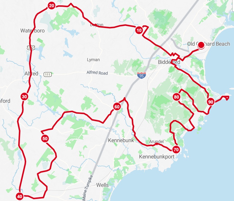
Directions for 100 Mile Ride - updated route 2026
This 100-mile ride offers a mix of rolling hills, scenic countryside, and coastal views, making it a rewarding challenge for seasoned cyclists. With a 2,713-foot elevation gain, the route blends flat stretches with moderate climbs. Along the way, participants will experience the charm of coastal Maine towns and landscapes, supported by rest stops to refuel. This ride is perfect for those seeking a full-century adventure while enjoying a variety of terrain.
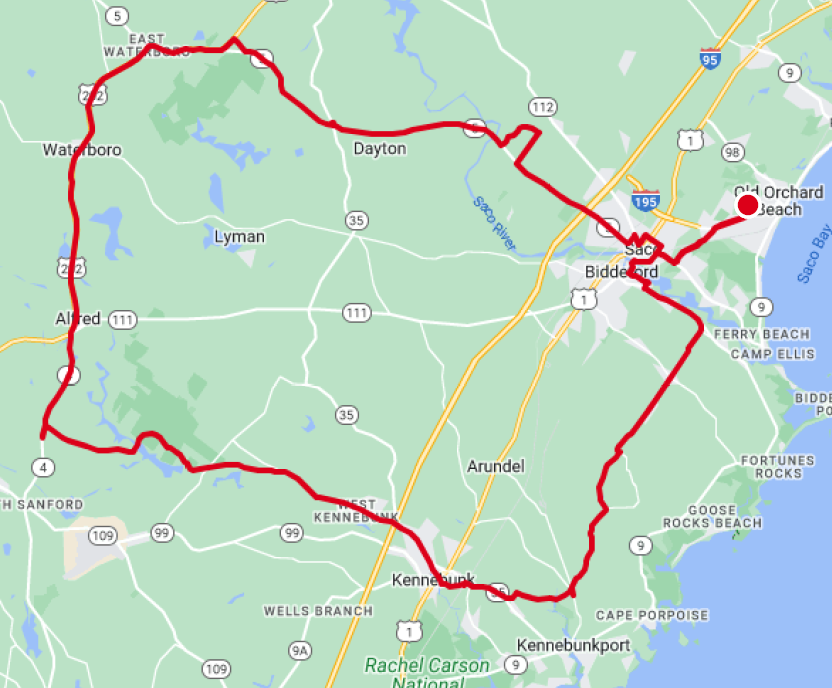
Directions for 62 Mile Metric Century
This 62-mile ride offers a scenic and moderately challenging course with a 1,576-foot elevation gain. Cyclists will enjoy a mix of rural roads, gentle climbs, and rolling terrain, ideal for riders seeking to test their endurance without the intensity of a full-century ride. The route features rest stops and highlights the natural beauty of New England, making it a perfect choice for intermediate to experienced cyclists.
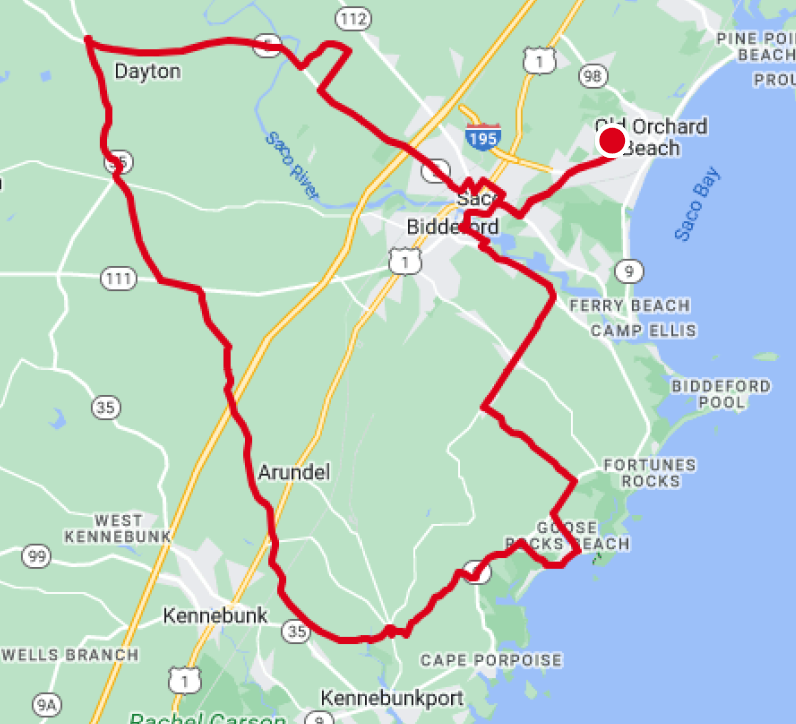
Directions for 50 Mile Ride
The 50-mile route features rolling terrain with an elevation gain of 1,369 feet, offering a scenic ride through quiet roads of Maine. The course combines manageable climbs with flat stretches, making it perfect for intermediate cyclists looking for a balanced challenge. With rest stops along the way and diverse scenery, this ride ensures a rewarding and enjoyable experience for participants.
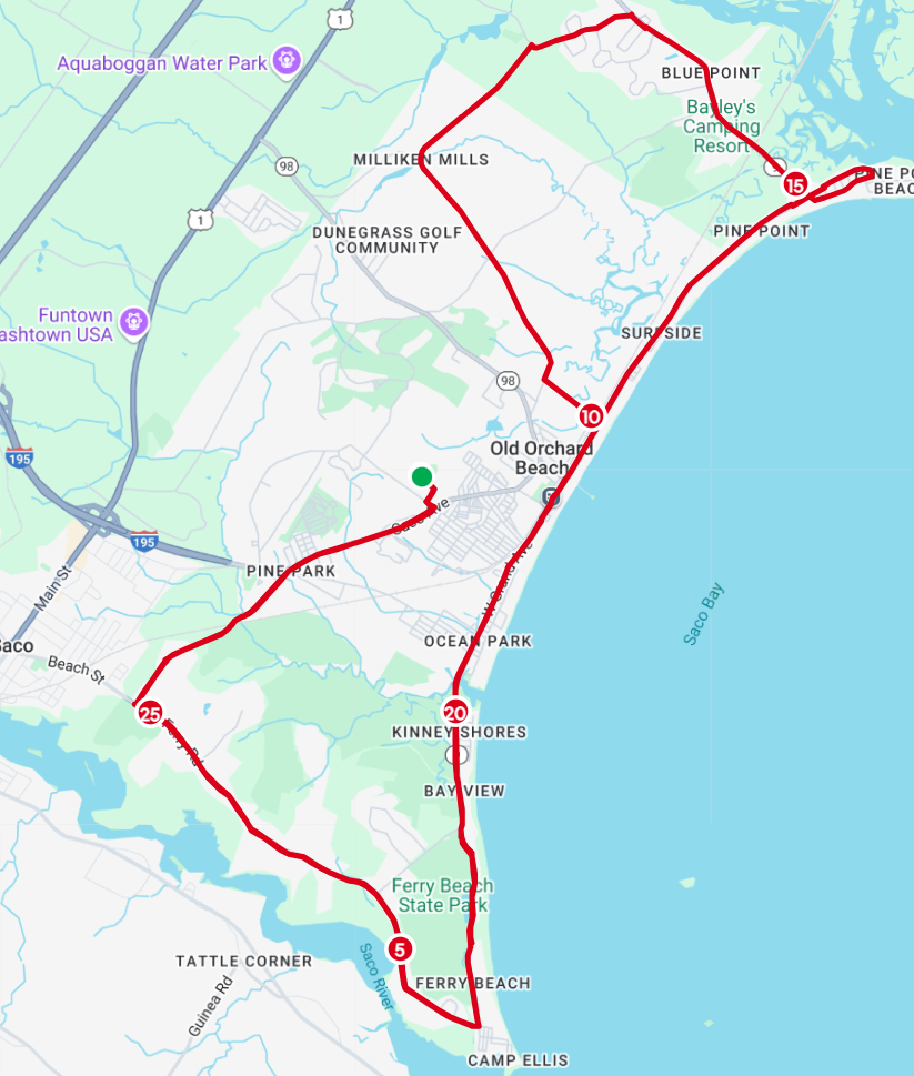
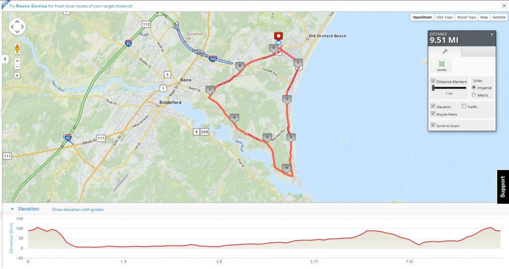
Directions for 30 Mile Ride
The 30-Mile Route offers a scenic coastal ride through Old Orchard Beach, Ferry Beach, and Pine Point, with ocean views and quiet residential roads. Riders will enjoy a relatively flat course with rest stops approximately every 10 miles. It’s a great option for cyclists looking for a manageable yet rewarding ride along Maine’s southern coast.
Directions for 10 Mile Ride
This 10-mile route is perfect for beginners or families looking for a leisurely cycling experience. With a gentle elevation gain of 257 feet, the ride takes participants through quiet roads and scenic surroundings, offering a relaxed pace suitable for all skill levels. The route’s manageable distance and supportive environment make it a great introduction to the New England Parkinson’s Ride.
Tracking Information
We have tracking mats at certain locations on the 100, 62, 50 & 30 mile routes. Once the tracking link is live, you may visit the site and search for your family or friends to follow their progress. Please note, this is not LIVE tracking, it will only show the times that they enter and leave certain rest stops so you have a sense of where they are.
Volunteers have graciously created a variety of ways for you to access maps & directions for all routes. They will also be well marked with color coded paint by route. Maps will be on display at start of the ride and at all rest stops, however, we suggest downloading one of the apps or printing out a copy for yourself before heading to Maine!
Please note, the routes may be subject to change based on circumstances beyond our control and will be communicated to all cyclists.